Authentic Ancient World
I've set this thread up for the awesome cddsullivan and neusaap.uit.brazil to have a working space concerning the construction of the campaign setup. I will support them with what I can and invite everybody else to contribute to the cause.
Concept of the Campaign Framework It is not an easy thing to construct a complete campaign map. There is a lot of research involved, but it is the foundation on which everything else of any total conversion modification builds on. It is even more of a challenge, especially because we are looking to create an even more detailed map than the current Grand Campaign map. Yes, we do expect CA to release their TEd map editing tools for Rome II at some point. So, there is need for concepts concerning:
Provinces
Given the release and characteristics of TEd map editing tools:
- Will there still be an UI limitation of how many regions a province can contain?
- If yes: How many and which new province groups would we need to introduce?
Regions
- How do we have to rename the existing regions?
Given the release and characteristics of TEd map editing tools:
- How could we split those existing regions into even more detailed regions?
- To which of the new provinces groups do we have to assign our new regions to?
Cities
- How do we have to rename the existing cities?
Given the release and characteristics of TEd map editing tools:
- To which of the new regions do we have to assign our new cities to?
Factions (Basic)
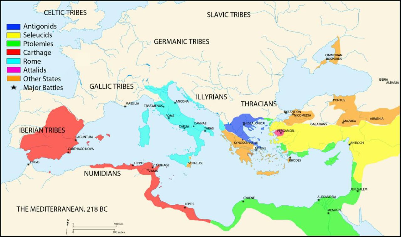
- Which factions did inhabit our campaign map in 217 BC?
- Where were those factions located in 217 BC?
- What culture did they belong to in 217 BC?
- How could we best incorporate those factions in our campaign framework?
Given the release and characteristics of TEd map editing tools:
- Which factions did inhabit our campaign map in 217 BC, but couldn't be implemented yet.
Factions (Advanced)
- How were the factions relations, respectively their diplomatic status towards their neighbors?
- Which factional political parties or dynasties played a vital role in 217 BC?
- Which factional standing armies played a vital role in 217 BC?
- Which factional characters played a vital role in 217 BC?
Cultures
- What was the approximate cultural and religiously mix within our regions and provinces?
- Which are the native owners and inhabitants of regions that were subjugated by foreign factions by 217 BC?
Resources
- Which wonders were present?
- Which natural resources did our regions contain?
- Which resources or manufactural goods where our regions famous for?
- Which of our regions were famous for being a mercenary hub and which mercenaries were hired there?
(!) Climate and Geography
- To which climate zone do we have to assign our regions?
- What were the major characteristics of the regional geography?
Links, Tools and Reference Points
- Wikipedia
- Rome II Interactive Map
- World History Atlas and Timelines
- Roma Surrectum II (217 BC) Campaign Map
- Rome: Total Realism Campaign Map
- Europa Barbarorum, Campaign Map
- Rome II: Total Realism Campaign Map
- Caeser in Gaul DLC Campaign Map
- Hannibal at the Gates DLC Campaign map
- EU: Rome Campaign Map
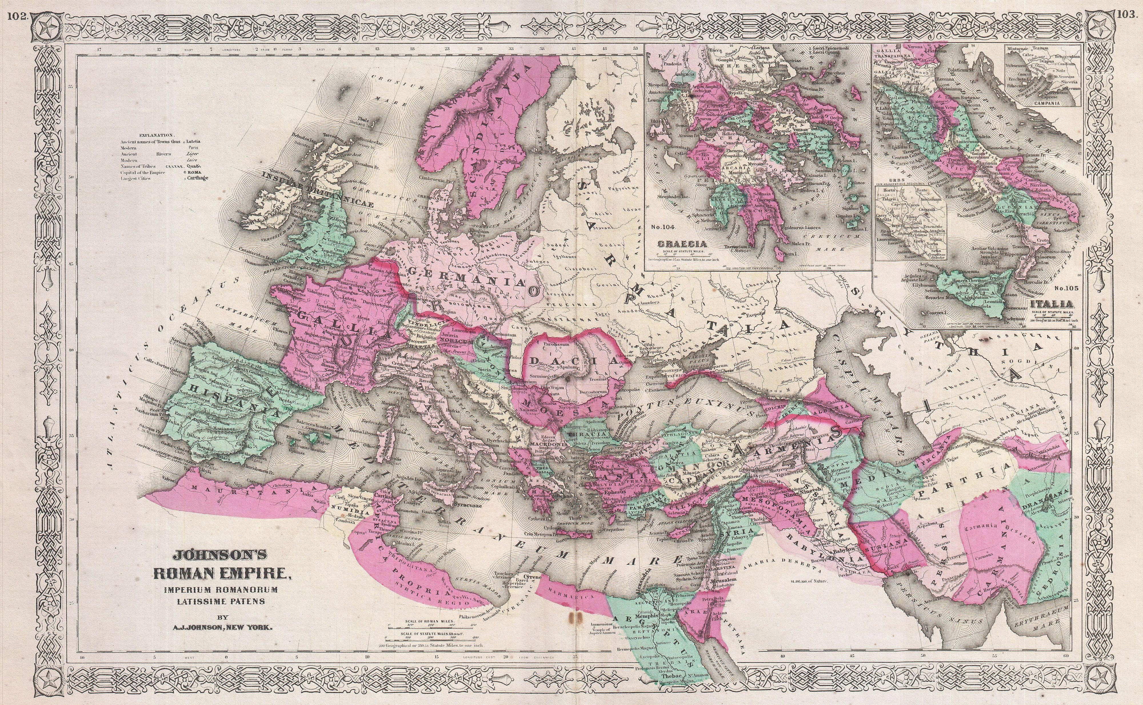
World Maps
Maps of the World
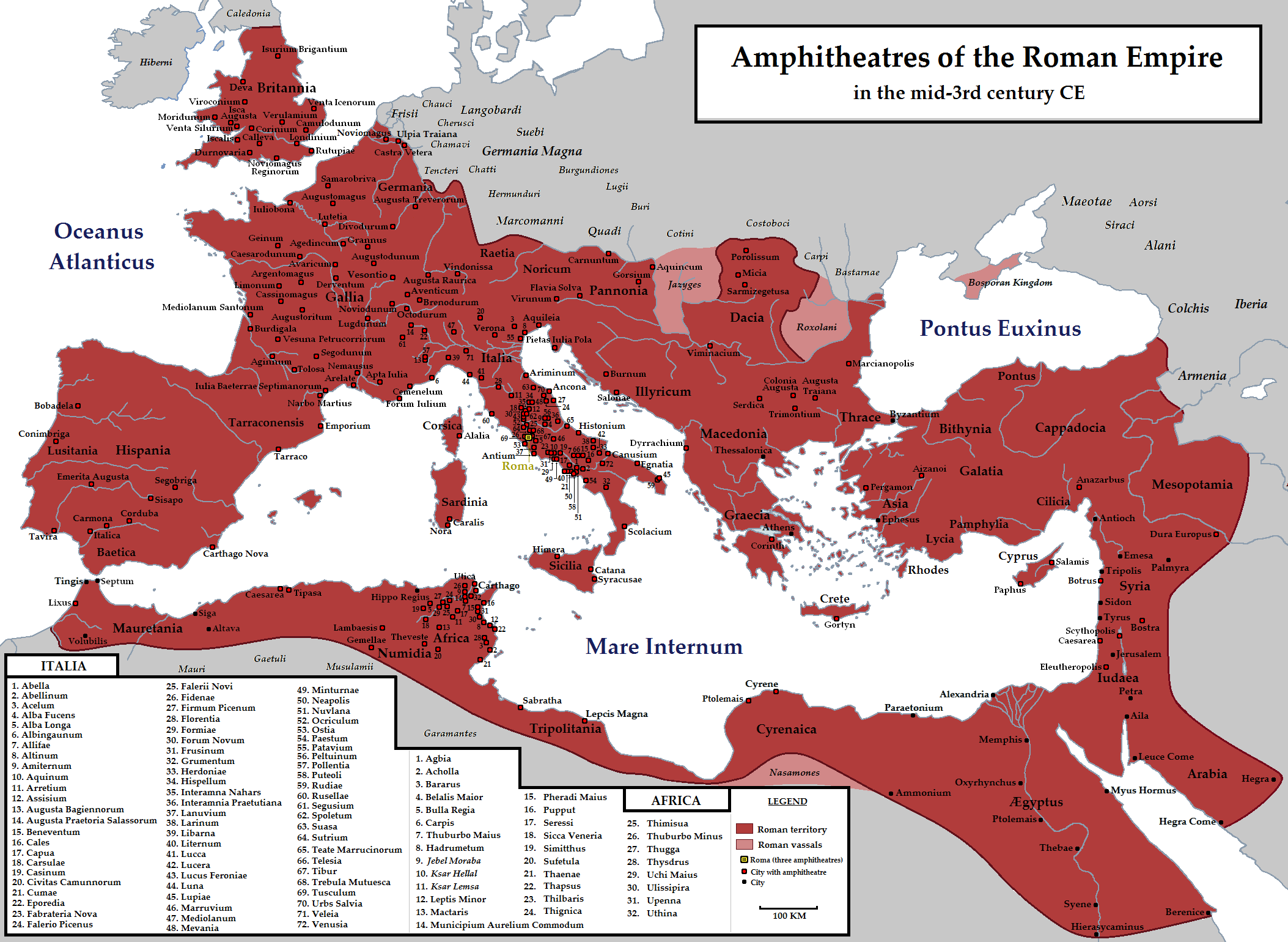
Rome II Campaign Map: Settlements, Resources, Wonders, Factions, etc.
Spoiler Alert, click show to read:
Britannia
Maps of Britannia
Britannia (undated)
Britannia et Hibernia (undated)Spoiler Alert, click show to read:.jpg)
Roman Britannia (AD 150)Spoiler Alert, click show to read:
Roman Roads in Britain (undated)Spoiler Alert, click show to read:
Roman Britain: Industrial Mining (undated)Spoiler Alert, click show to read:
Roman Britain: Industrial Production (undated)Spoiler Alert, click show to read: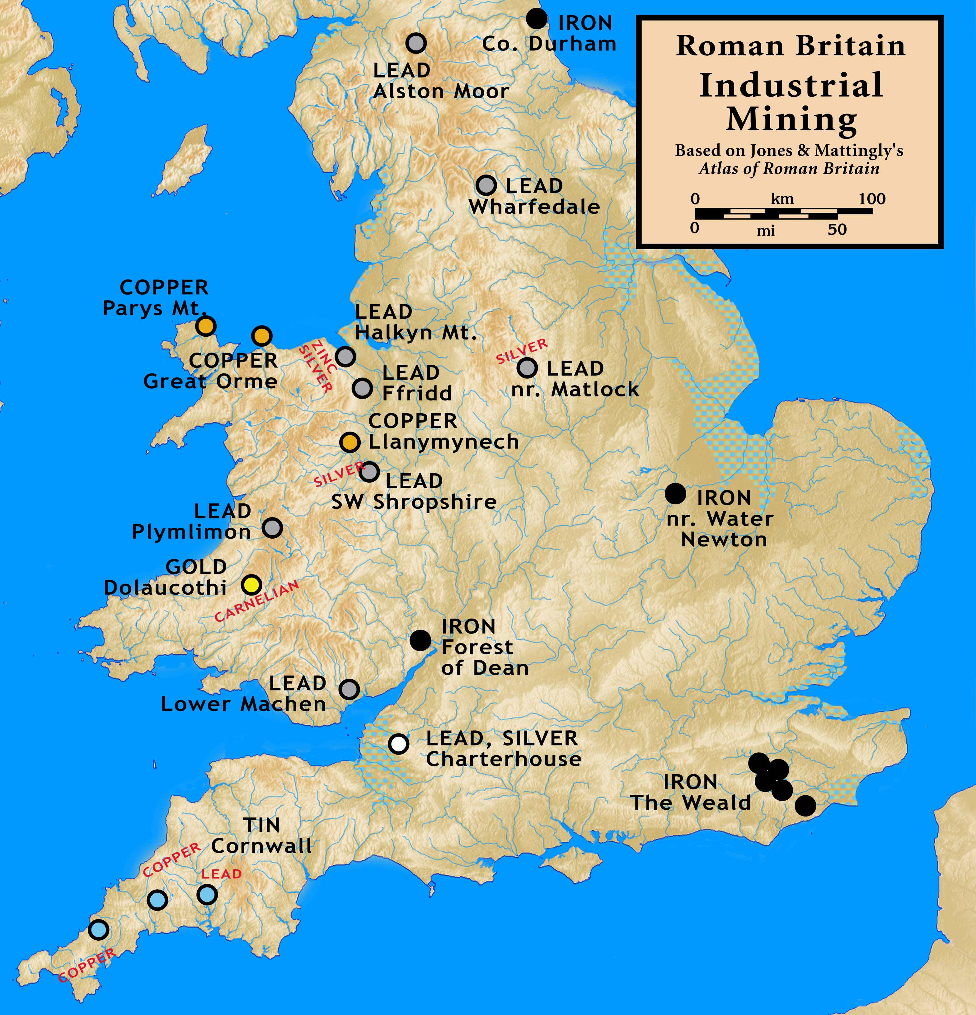
Insulae Britannicae (undated)Spoiler Alert, click show to read:
Spoiler Alert, click show to read: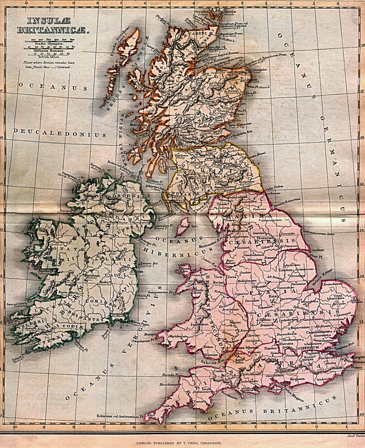
Gallia
Maps of Gallia
Gallia (undated)
Gallia (undated)Spoiler Alert, click show to read:_1899.jpg)
Gallia (undated)Spoiler Alert, click show to read:
Roman Gaul (undated)Spoiler Alert, click show to read: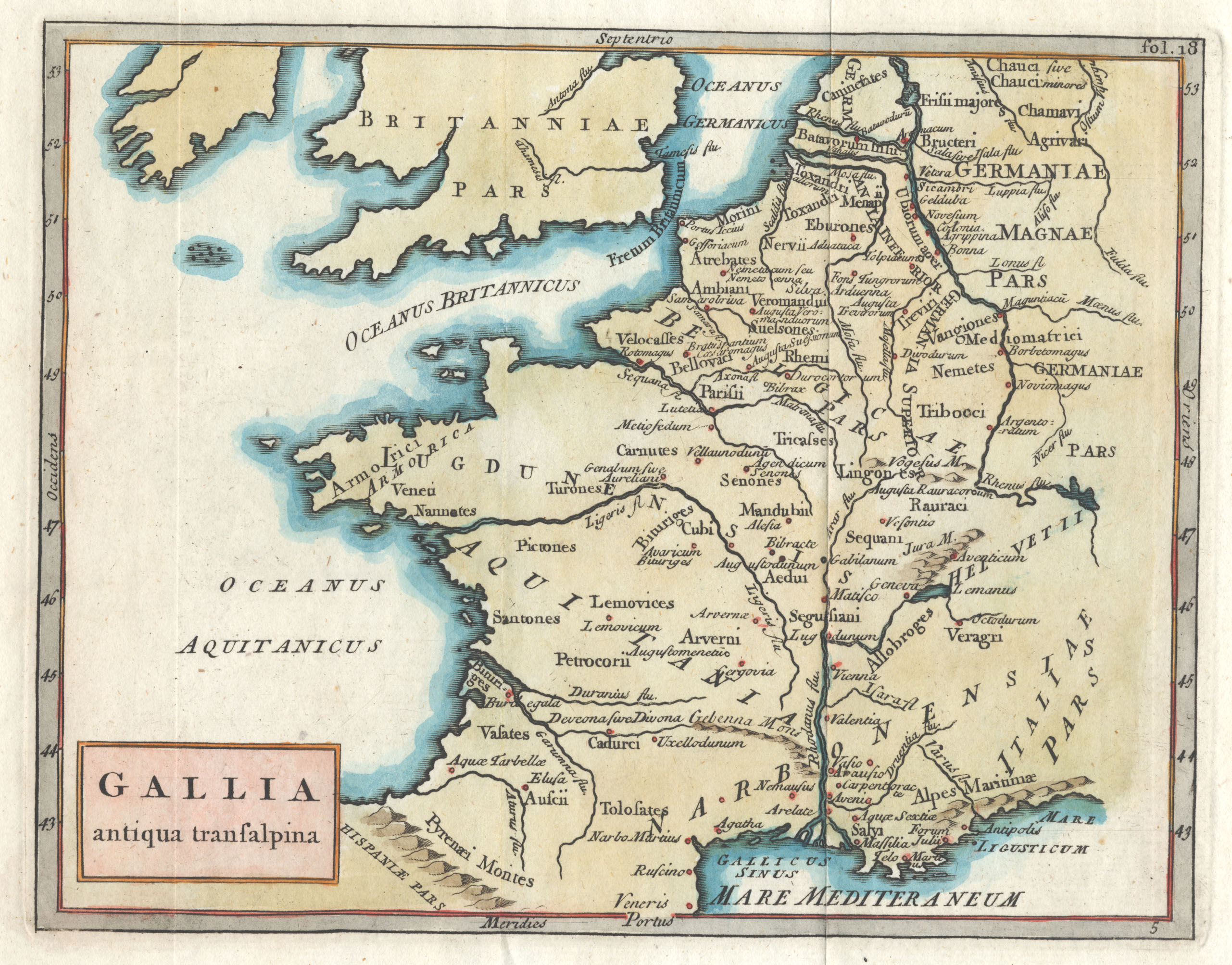
TWRII CiG Campaign Map (undated)Spoiler Alert, click show to read: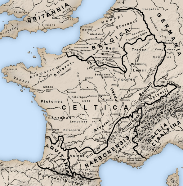
TWRII CiG Factions Campaign Map (undated)Spoiler Alert, click show to read:
Spoiler Alert, click show to read:
Hispania
Maps of Hispania
Hispania (undated)
Hispania (undated)Spoiler Alert, click show to read: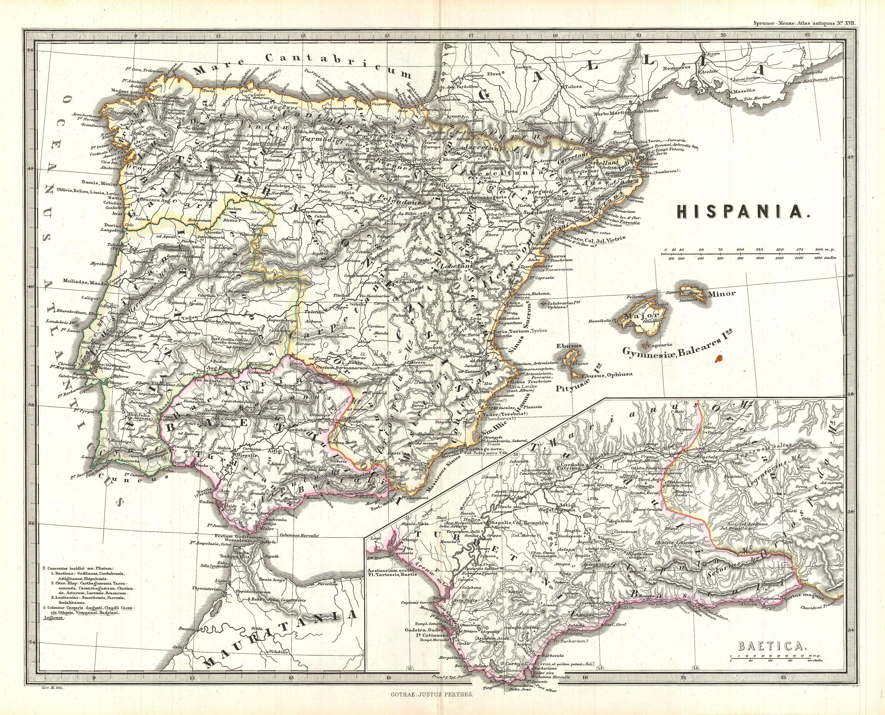
HispaniaSpoiler Alert, click show to read: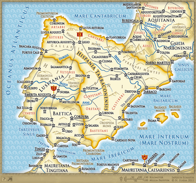
TWRII Faction Campaign Map (undated)Spoiler Alert, click show to read:
Hispania, Mauretiania and Africa (undated)Spoiler Alert, click show to read:
Roman Roads of Hispania (undated)Spoiler Alert, click show to read:
Roman Hispania: Industrial Production (undated)Spoiler Alert, click show to read:
Hispania: Ethnics (undated)Spoiler Alert, click show to read:
Hispania before the Carthaginian Conquest (300 BC)Spoiler Alert, click show to read:
Hispania during the Carthaginian Conquest (237 - 206 BC)Spoiler Alert, click show to read: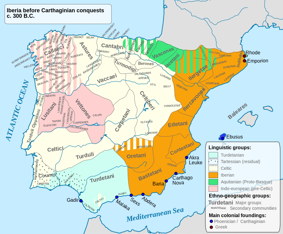
Hispania (196 BC)Spoiler Alert, click show to read:
Spoiler Alert, click show to read:
Mauretania
Maps of Mauretania
Mauretania (undated)
Mauretania et Numidia (undated)Spoiler Alert, click show to read: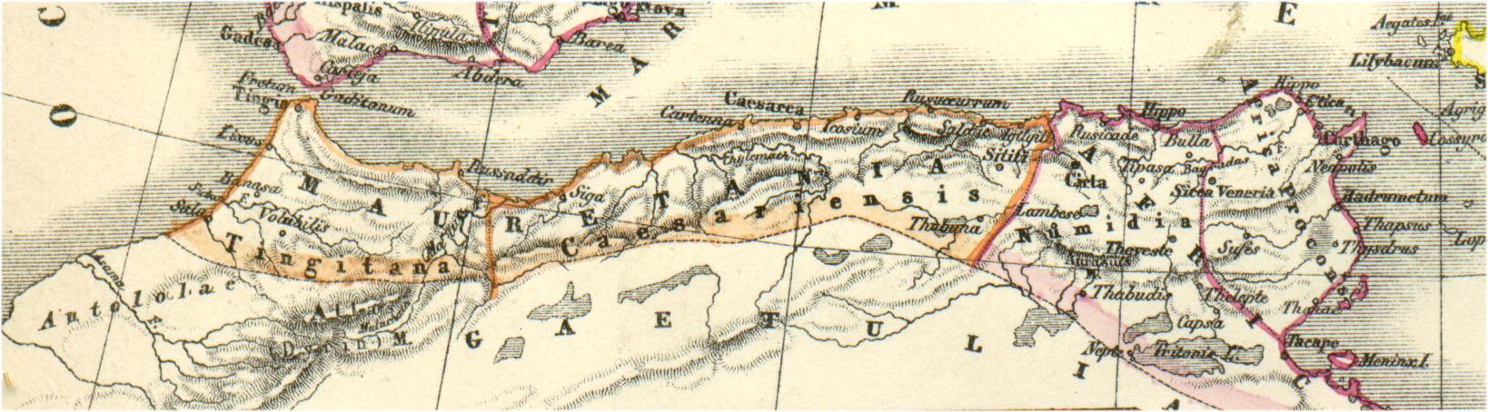
Mauretania Tingitana (undated)Spoiler Alert, click show to read:
Mauretania Cesarensis (undated)Spoiler Alert, click show to read:
Spoiler Alert, click show to read: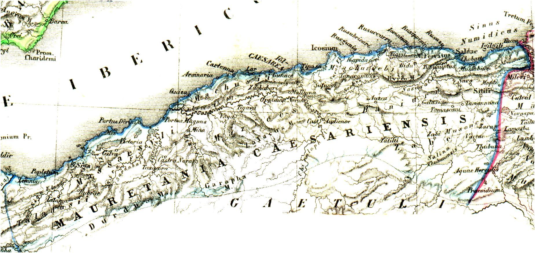
Africa
Maps of Africa
Africa (undated)
Africa Antiqua (undated)Spoiler Alert, click show to read:
Roman Africa (undated)Spoiler Alert, click show to read:
Roman Africa (undated)Spoiler Alert, click show to read:

Spoiler Alert, click show to read: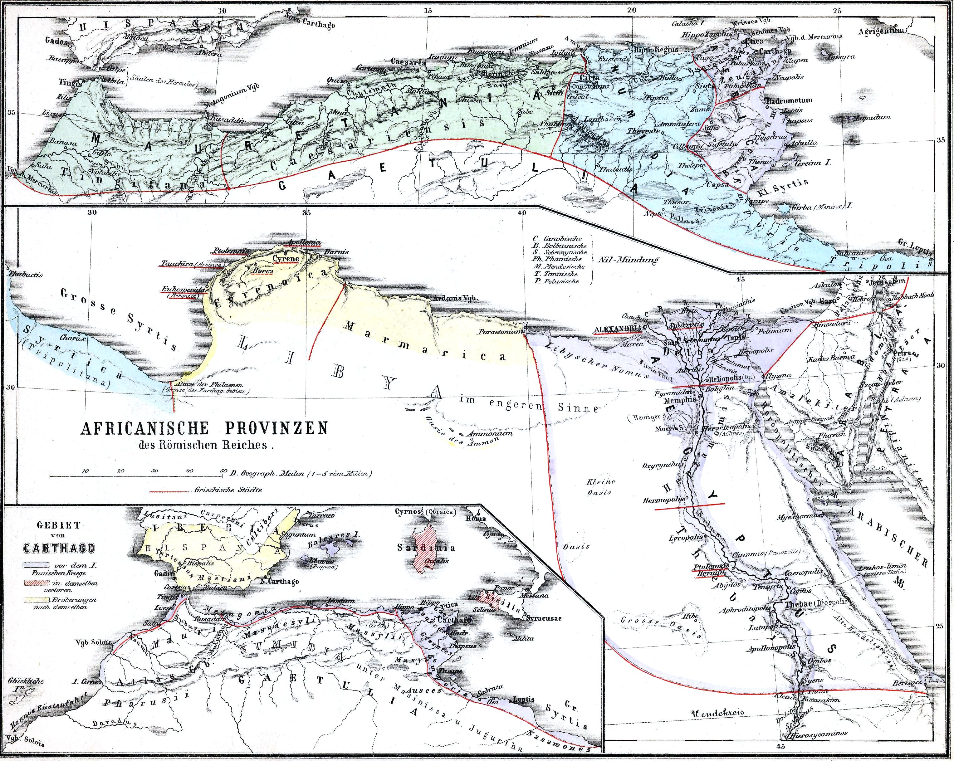
Lybia
Maps of Lybia
Lybia (undated)
Spoiler Alert, click show to read:
Aegyptus
Maps of Aegyptus
Aegyptus (undated)
Aegyptus (undated)Spoiler Alert, click show to read:
Aegyptus (undated)Spoiler Alert, click show to read:_1900.jpg)
Aegyptus, Aethopia et Arabia (undated)Spoiler Alert, click show to read:
Ptolemaic Egypt (270 BC)Spoiler Alert, click show to read:
Ptolemaic Egypt (undated)Spoiler Alert, click show to read:
The Ptolemaic Kingdom: Territory (270 BC)Spoiler Alert, click show to read:
Spoiler Alert, click show to read: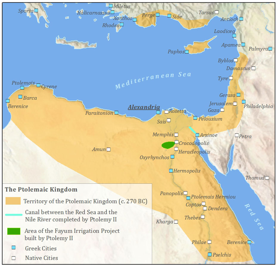
Aethopia
Maps of Aethopia
Aethopia (undated)
Arabia et Aethopia (undated)Spoiler Alert, click show to read:
Spoiler Alert, click show to read:
Arabia
Maps of Arabia
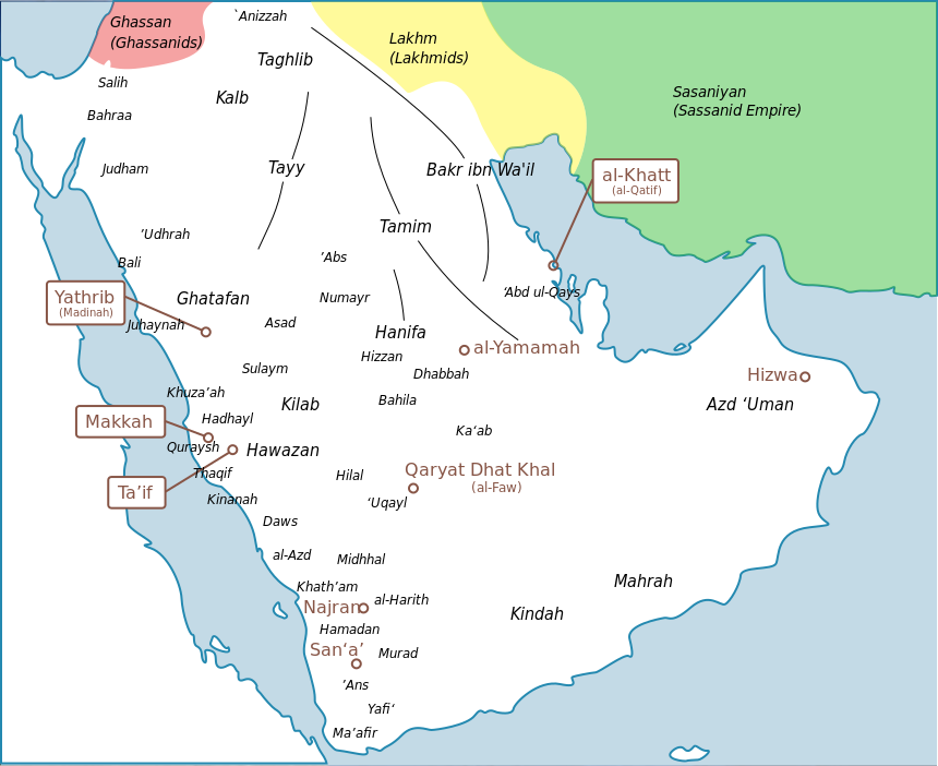
Nabataean Trade Routes (undated)
Arabae (undated)Spoiler Alert, click show to read: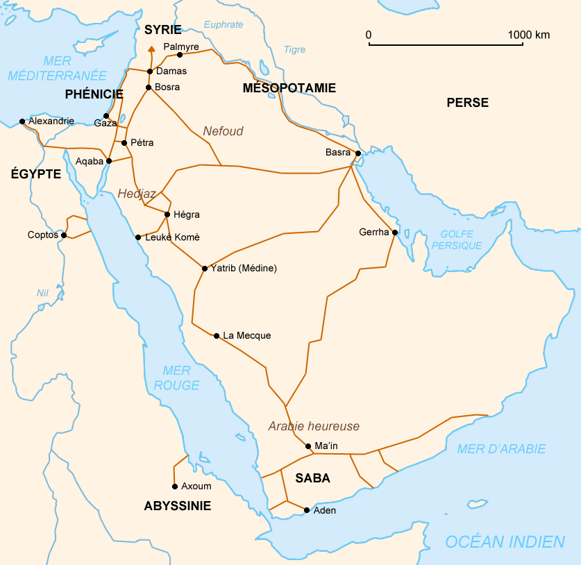
Arabia (undated)Spoiler Alert, click show to read:
Arabia (200 BC)Spoiler Alert, click show to read:
Spoiler Alert, click show to read:
Syria
Maps of Syria
Syria (undated)
Syria et Mesopotamia (undated)Spoiler Alert, click show to read:
Syria (200 BC)Spoiler Alert, click show to read:
Palaestina 1 (undated)Spoiler Alert, click show to read:
Palaestina 2 (undated)Spoiler Alert, click show to read:
Seleucid Empire (195 BC)Spoiler Alert, click show to read:
Spoiler Alert, click show to read:
Asia Minor
Maps of Asia Minor Asia Minor (undated) Asia Minor (undated)Spoiler Alert, click show to read:
Asia Minor (undated)Spoiler Alert, click show to read: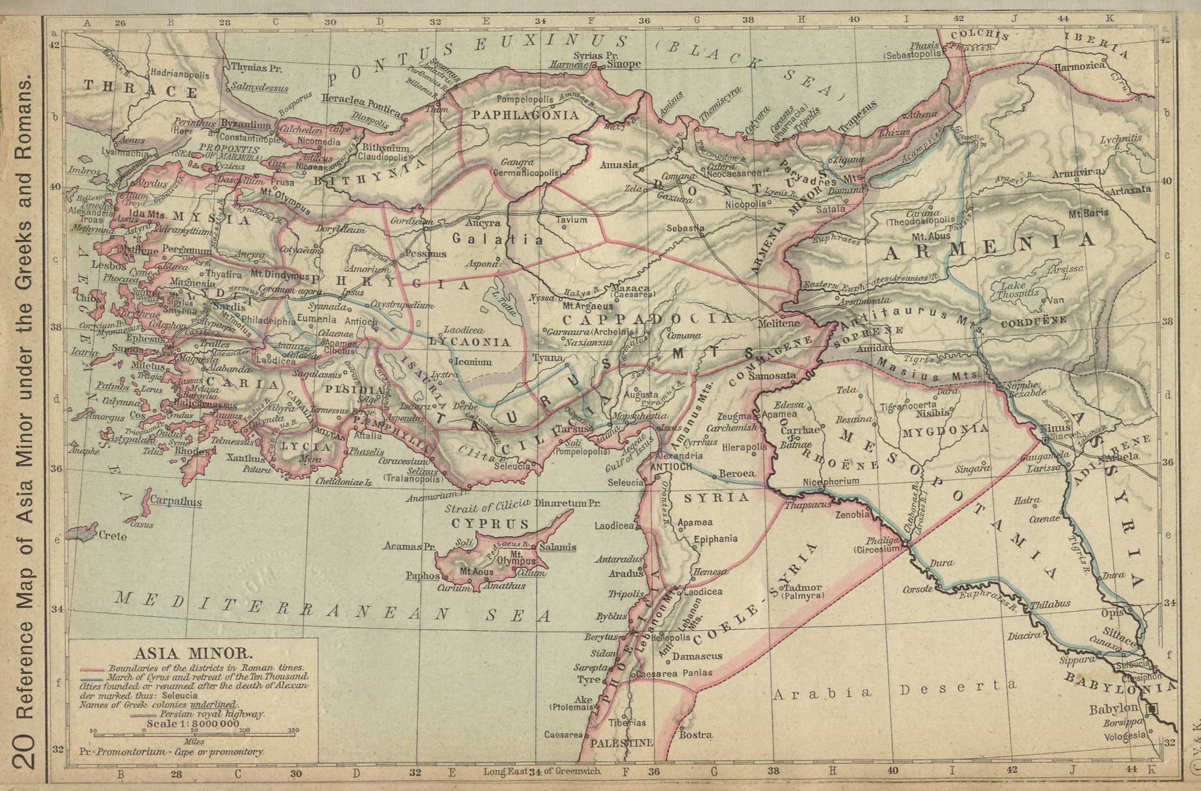
Asia Minor: Regions (undated)Spoiler Alert, click show to read:
Spoiler Alert, click show to read:
Mesapotamia
Maps of Mesapotamia
Mesapotamia (200 BC)
Mesapotamia Trade Routes (undated)Spoiler Alert, click show to read:
Messapotamia (undated)Spoiler Alert, click show to read:
Spoiler Alert, click show to read:
Armenia
Maps of Armenia
Armenia (undated)
Spoiler Alert, click show to read:
Ariana
Maps of Ariana
Oriens (undated)
The Oriental Empires (600 BC)Spoiler Alert, click show to read:
The Persian Empire (500 BC)Spoiler Alert, click show to read: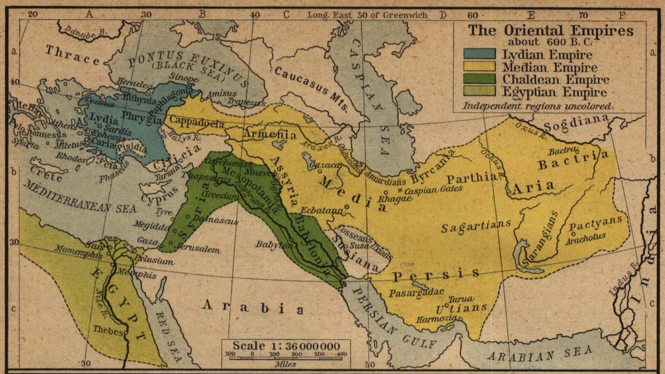
The Persian Empire (500 BC)Spoiler Alert, click show to read:
The Persian Empire during the time of Alexander the Great (undated)Spoiler Alert, click show to read:
The Empire of Alexander (334 - 323 BC)Spoiler Alert, click show to read:
Alexander's Empire (undated)Spoiler Alert, click show to read:
Spoiler Alert, click show to read:
Persis
Maps of Persis
Persis (undated)
Spoiler Alert, click show to read:_-_Geographicus_-_Persis-spruneri-1855.jpg)
Gedrosia
Maps of Gedrosia
Alexander's Empire (undated)
Spoiler Alert, click show to read:
Bactria & India
Maps of Bactria & India
Greco-Bactrian Kingdom (undated)
India (undated)Spoiler Alert, click show to read: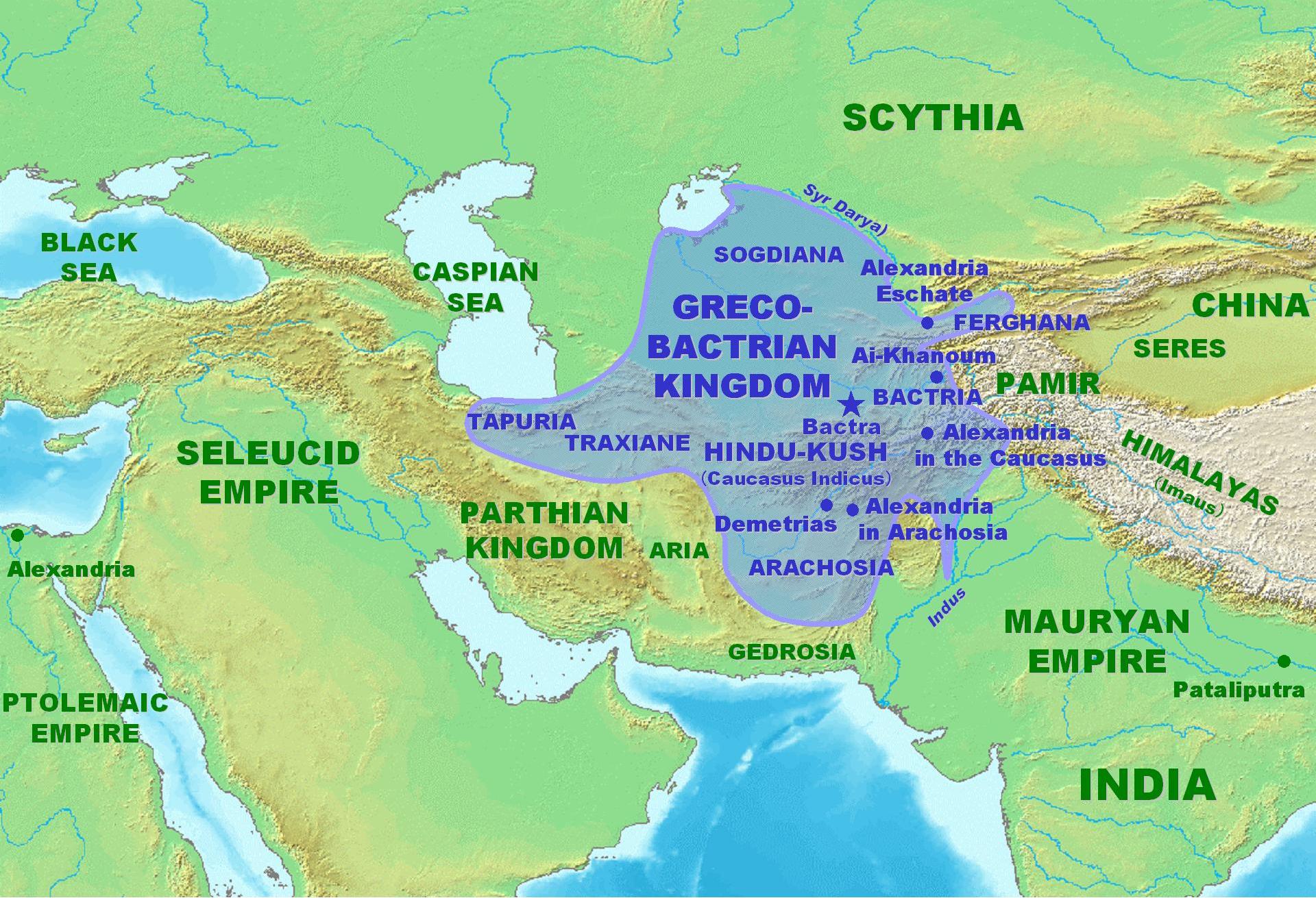
Alexander's Expeditions (undated)Spoiler Alert, click show to read: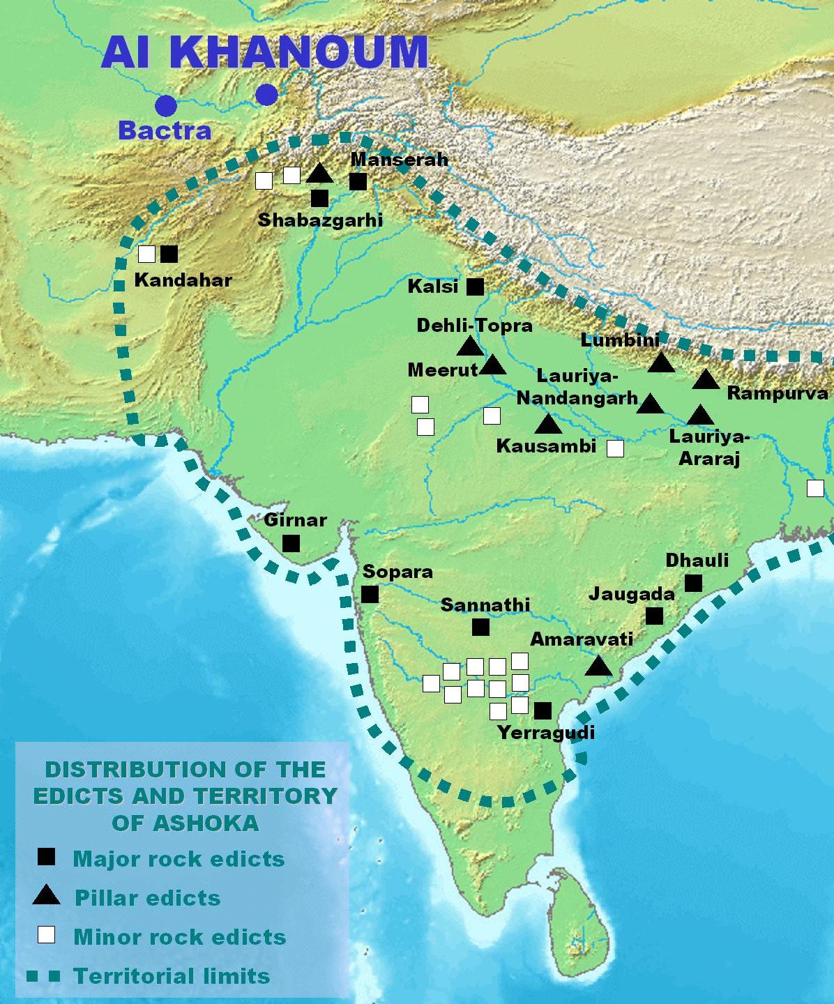
Spoiler Alert, click show to read:
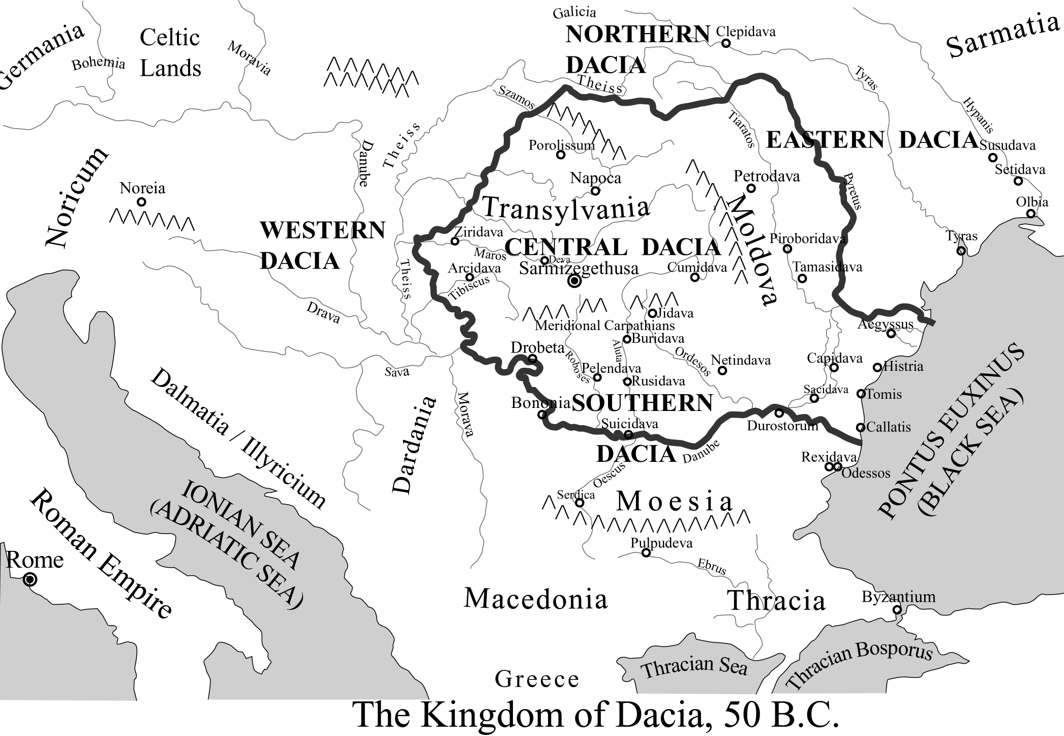
Scythia & Sarmatia
Maps of Scythia & Sarmatia
Greek colonies in Scythia (undated)
Sarmatia et Scythia (undated)Spoiler Alert, click show to read:
Roman Empire (AD 125)Spoiler Alert, click show to read:
Scythia and Sarmatia (undated)Spoiler Alert, click show to read:
Scythians (undated)Spoiler Alert, click show to read:
Scythian (undated)Spoiler Alert, click show to read: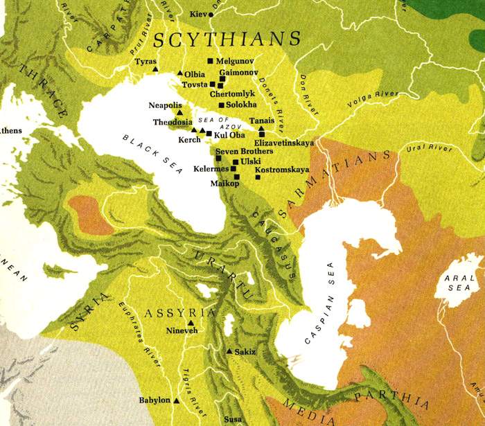
[Spoiler]Sarmatia Antique (undated)
Spoiler Alert, click show to read:


 Reply With Quote


_1900.jpg)


 That moment all hope was lost for this company.

 thank you all and its receiving great feedback