That you can have 12 types of Agents. Like spies, merchants, assassins, priests, princesses, inquisitor, etcOriginally Posted by TAKEDA ⬤ SHINGEN


That you can have 12 types of Agents. Like spies, merchants, assassins, priests, princesses, inquisitor, etc
Ok but how? I did try for exemple to add the action assassinate to the merchant, but it doesn't work, so how is it possible to create a new agent and gave them actions that doesn't work? Or is it because you can't add actions to existing agents and only to custom ones?
No one knows nor have tested it? No one know from who comes this information?


")
")
You'll need to wait more than a day for the appropriate figures to roll around, mate. It's a bit slow, but there it is. I personally never went into the subject as I figured doing so was impractical early on given the murky nature surrounding actual agent work (since, to my knowledge, much is hardcoded and the rest is a pita to make work).
I'm just curious where did he get his information and how was it tested since it is already known, like you said, that most things about agents is hardcoded and adding actions to agents is impossible. So is this list verified or is it just an amalgam of rumours and verified limits all put together? Since it is a stickied post, I suppose it has more rigor than just mixing all infos coming from everywhere and anyone, but I'd like confirmation and the source of this specific info about agent.


")
")


")
Oh, this seemed as a very new interesting thing, was already thinking about how to use it... But the game failed us again, I suppose the limit was just ill formulated?
Based on this thread its actually 12 types of characters in descr_characters, not agents.
And based on what Gig said, you can neither change actions linked to the agents
Last edited by Jadli; April 19, 2020 at 04:02 AM.

Sorry if I´m making a stupid question or its resolved on this thread´already, but to define land masses concretely, you mean "the group of entire pieces of land". So we are considering islands even if they are of one pixels or whole asia continent, right?
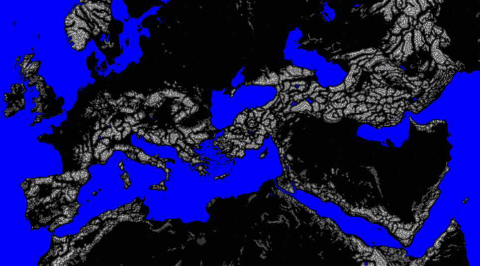
I know that RTW it has the same (or very similar) hardcode limits and I have a functional map that it has more than 20 land masses. Even if you consider the map_heights.tga or if you count from map_region.tga
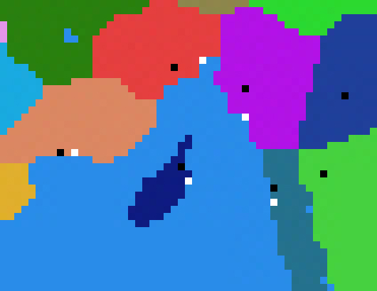
I´m writting here to ask about the definition of landmasses but even to help to define this concep because I can show a picture where this limit is ignored in a complete functional map, only having a little graphic glitch on Aegean isands... but I removed all "extra" land masses and this glitch was persisting so I think that is not related.
I hope that someone can help me and this question is helpful.
Kind regards
You need to try to understand these bits from B.Ward's post that's linked to in your quote:
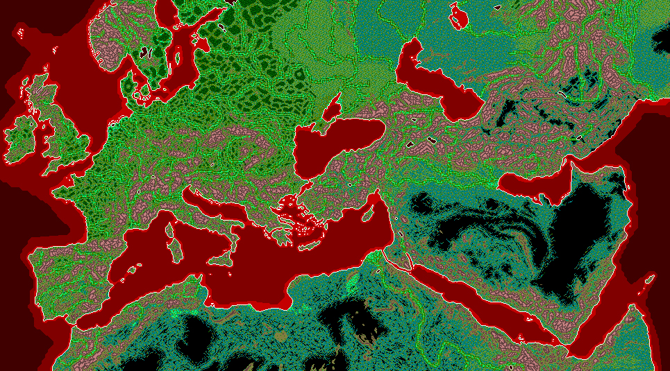
The map you need to be looking at is map_regions. If on that 'Cyprus' is one solid region colour, then that will count as 1 of your 20 possible land-masses. If a region on the turkish mainland also owns a little bit of the Cyprus island shape, e.g. there's some pixels of that mainland region's colour on the Cyprus shape, then it doesn't count as a separate land-mass, and so doesn't count towards your total.
A lot of the islands that show up on those map_heights/ground_types are just decorative features that belong to regions on the nearest mainland, so they don't count as "land-masses"
clear as mud?
Visit Total War Center Wiki for:
Total War Mods - Modding Portal - Total War Series
M2TW Modding - Battle Map Buildings - Techtrees - worldpkgdesc
Rome Remastered Modding - New Campaign Map
IWTE functions for RR - Unit models in RR
Thanks so much, I think that I got it, but only to clarify completely, I´m going to show some examples and you can tell me if I´m wrong.
1. Cyprus count like one land mass because is not coneccted with continent by land, or region color, as you said.
2. Even been separate island not conected by pixels, Balearic island count as one land mass because they make part of the same region.
3. Two different provinces with a single separate pixel on the sea. Are they counting like the same land mass of the continent? Counting like one?
4. Following this logic, Ireland will be one land mass and England, Scotland, Orkney and other small island another land mass. Counting like two.
Last edited by Solon de Atenas; May 29, 2020 at 05:10 AM.
Yep - that's what I think it means
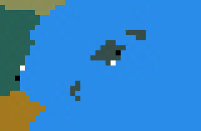
The channel island bit in pic 3. would be counting as part of the European land-mass.
The only complication might be in pic 4. with ireland - IF the bit between ireland and scotland is actually a natural (map_heights generated) land-bridge, that might mean that would all count as just one land-mass - I'm not sure on that point...
Visit Total War Center Wiki for:
Total War Mods - Modding Portal - Total War Series
M2TW Modding - Battle Map Buildings - Techtrees - worldpkgdesc
Rome Remastered Modding - New Campaign Map
IWTE functions for RR - Unit models in RR
It´s not. In game, there are no way to cross it with troops. But I understand the point. It´s separated by two pixels, so following this logic, Irelando should be a separate land mass.
Thanks for you answer and your time. It was so helpful to my map. Great Makanyane! +rep
=)
More than 65 .cas files with valid names (e.g. listed in descr_cultures, and not left behind '...copy_of.cas) in models_strat/residences/faction_variants/faction_name folders cause a crash and hang on exiting campaign.
See here for me testing it whilst trying to find out about shadow problem.
EDIT: this is on a 5 culture mod - just realised the limit might be lower on a 7 culture mod, if total number of culture .cas variants includes the culture set ones
Last edited by makanyane; July 07, 2020 at 10:51 AM.
Visit Total War Center Wiki for:
Total War Mods - Modding Portal - Total War Series
M2TW Modding - Battle Map Buildings - Techtrees - worldpkgdesc
Rome Remastered Modding - New Campaign Map
IWTE functions for RR - Unit models in RR

I think I found a new one, I tried to add music and whenever the regenerated music.dat file went above 3.5GB it crashed, I tried with different combination of mp3 files in the descr_sounds_music and all gave the CTD, and none when the file was below that size.
I don't know if that would confirm it (I think it would), if anyone has any other idea, please indicate me.
Last edited by removeduser_28376423423; November 24, 2020 at 02:58 PM.


Number of custom tiles in custom_tiles_db.txt is 100.
add this to the list please.
Soldier unit textures:
Smallest mip level displayed in battle is the one whose size is 32x32 pixels
This is the last mip level to be displayed by engine at large distance before turnning to sprites (*)
If the unit entry lacks sprites in MODELDB file, the 32x32 mip level will be displayed at the largest distances.
(*) A short max distance in MODELDB file combined with lower unit detail in video config can make engine turn to sprites at shorter distance.
-With 1024x1024 textures the larger mip levels (1024x1024 and 512x512) will be displayed close to the unit
As distance increase, smaller mip levels (256x256, 128x128, 64x64 ) will be displayed, but engine will never pick a mip level beyond 32x32.
-With 32x32 texture, the larger mip level (32x32) is the only one to be displayed.
On the other hand:
-If the texture itself is 16x16, its larger mip level (16x16) will be displayed (smaller ones will not).
----
Edit:
Attached a pack of "multicolor" textures used for testing the above:
One solid color for each MIP Level
en_peasant_padded_xcolor.zip
Last edited by Hexdragon; June 06, 2021 at 04:01 PM.
From my experience, the maximum number of export trade fleets a port city can have is 4. This appears to be hardcoded.
A city will use land routes to trade with adjacent provinces, but once those are used up, it will use trade fleets up to a maximum of 4 outgoing.
If someone can show me something different, I would love to see it.

")


Trade fleets: in Gigantus testing: export is max 3 lines, import is max at 4 lines. Plus they're hardcoded to the port buildings. The land connections only prevent the sea trade from being established (land has a priority, and there can be only one link), but their number has no impact.
descr_mounted_engines.txt can have up to 4 entries. more than this and the game will crash and the log will tell you the limit was reached
The hardcode for export fleets is actually 4 outgoing sea routes. I posted this over at the thread about Ports being Bugged. Here is another pic of my game:


 Reply With Quote


")


")
 The only downfall as far as aesthetics goes, is sometimes the miscellaneous pixel will cause a short region border to show up on the strat map, but I have faction borders invisible on my strat map, so it's not a big issue. Also, by connecting land masses, it helps the AI a bit with actually traveling to islands and other areas since they are technically "bordering" them.