I d like to ask about 3 places of campaign map - is it an intention or mistake? I know its cosmetical detail but You know... Roman empire 
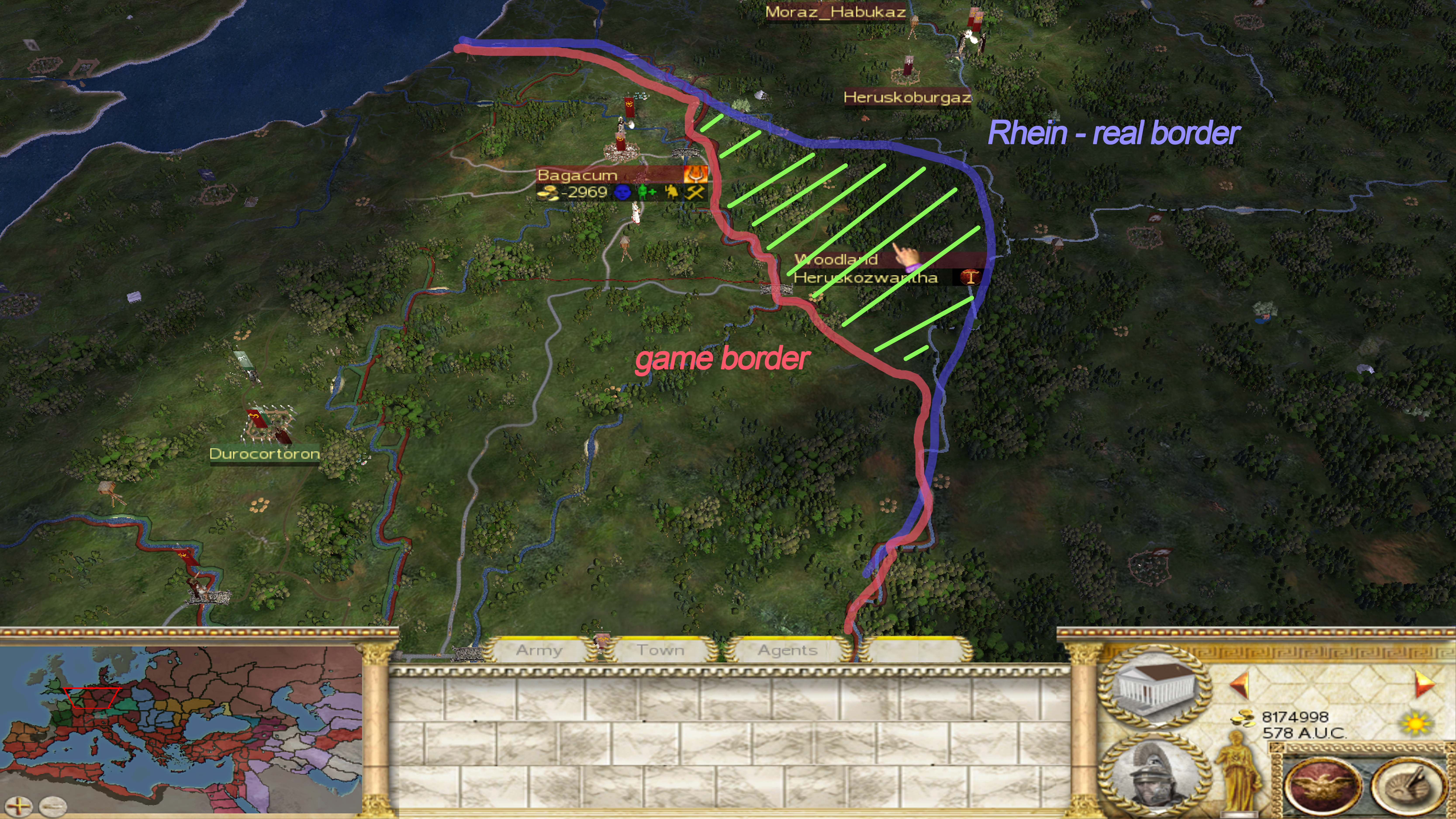
1) Rhein limit - border of province is not on river, but to the west of it. Also i think there should be more cities on this Limit but what is more important different names like Germania Superior, Germania Inferior - with cities like Colonia Agrippina and Augusta Treverorum - and camps like Vetera, Bonna, Moguntiacum, Argentoratum Vindonissa instead just Bagacum (Nervicoranda) and Vesontio (Sequanilanda).
Look at original map of Barbarian Invasion (border on the north isnt visible because of player who conquered Campus Frisii north-easth from Rhein)
and look on actual RS III map
2) Danube limit - river is heading to the south in Panonia just near Carnuntum (between Panonia Superior and Inferior) instead around Aquincum (Panonia Inferior)? But province borders are correct at all.
3) region between Danube and Rhenus - Volcabrog - roman name was Agri Decumates ( boders are OK i think)


 Reply With Quote


 and to a lesser degree the same with archers, it's not a bug afaik.
 I control Sicily, obviously including Akragas, therefore nullifying the possibility of triggering the Reforms script via the construction of the Palace of Praetor Vicarius. I have raided and sacked all settlements from Rhegion to Patavium on the East coast of Italy to help destroy the Romani economy as part of my pre-Marian strategy and for a bit of added fun. I have conquered all the Adriatic settlements from Thermos to Segestica, still this does not seem to have affected the Romani economy or growth. I sent a spy to Mediolanum Genoa Arretium Roma,& Capua and they are all are able to recruit various Marian units, but not the Praetorian Cavalry, Early Praetorian 1st Cohorts or Early Praetorian Cohorts that make up one army in Transalpine Gaul which I am soon to face, so where have these units come from? How is it possible? unfortunately these errors have seriously
  up my strategy and will no doubt have adverse effects on my Let's Play campaign , Hells teeth, it's really going to be fun trying to win now


