Not a bad concept. How big are you considering making the map? I'm guessing you would prefer more field battles for this mod.
The geographic area would cover roughly the area I showed in my second post. In terms of scale the map would perhaps be 3 or 4 times larger than the area Britain occupied in vanilla M2TW. Field battles would definitely be preffered so I'd look to limit the number of regions to cover the major towns only.
Excellent project brief AD, I've always believed in the potential of this conflict on the TW engine and it's always exciting to see people considering such projects, especially modders of such accomplishment. Hope it makes progress!
Thanks for the support. I firmly believe that the future of Total war modding can not exist in the "super-mods" anymore. The quantity of work that a mod team needs to produce is increasing exponetially with each iteration of Total war. It seems logical to produce small scale mods with limited aims.
but there are plenty of possibilities for individual "unique" units to distinguish the two sides, like the Ironside cavalry (and the New Model Army in general) for Parliament and units like Prince Rupert's Bluecoats for the Royalists.
As Firekiller's excellent research has shown, many Royalist regiments had their specific coat colour. This puts me in a bit of a quandry. I could easily produce the 7 different 'coloured' skins for the regiments that firekiller posted. I could even make it so that you can only recruit unit X from the historical region it came from (The Marquess of Winchester his Regiment of Foote unit only being available in Winchester for example). However this would create a huge problem, you could not merge different regiments of infantry and you would have to send the unit all the way back to it's recruitment point to retrain it.
This would be +5 to historical accuracy and -15 to gameplay. It would be a huge disadvantage to the Royalist player in comparison to the NMA which would be mergable and retrainable every where they have support.
FWIW I would join with sirfiggin in emphasising the desirability of featuring Scotland and Ireland for a realistic scope of the conflict, they were 3 kingdoms with one king after all.
I understand your point entirely. The conflict between Ireland and Scotland is important, however my main aim is to simulate the war within England. The scope for mods can rapidly get 'out of hand' and before you know it there's a faction list as long as your arm and a unit list for each faction that makes your eyes water.
There's a further issue with adding Scotland. The Royalists will essentially be sandwiched between Scotland and the roundheads. The usual reaction from the campaign AI is to invade the bordering faction. I can forsee a problem whereby if I include Scotland they will go to war with the Royalists.
With BC we went step by step, faction by faction. The original aim was only to recreate a handful of 3 or 4 new factions. In the end it turned out to be 20+ factions.
Including all of the geographic area of Scotland and Ireland is a good idea and would future proof the map for the inclussion of Scotland and Ireland later on.
Cheers
Last edited by AlphaDelta; August 06, 2008 at 07:20 PM.
I am very interested. Especially considering the quality of work you are capable of, mapper and whatever else you would need should be no problem to find for you.
Last edited by Son of Mao; August 07, 2008 at 08:38 AM.
Nice undertaking AD, I am glad you decided to go one with your passion about this concept.
If you wish you can use my animation for pikemans from BC, at least untill someone comes up with something better.
Including all of the geographic area of Scotland and Ireland is a good idea and would future proof the map for the inclussion of Scotland and Ireland later on.
Future-proofing is all that I meant within this highly focused context. However I would point out that this era has little capacity for faction creep. There is no multitude of indepedent clans or rebel armies or whatever, there are really only 4 factions (Royalists, Parliament, Covenant Scots and Confederate Irish) that were unified "governments" and operated on any kind of large scale. Just about the only factions you could add to that would be the Scottish Royalists (a cause essentially embodied by the activities of one man, the Marquess of Montrose) and the Ulster-Scots. The former were a major military force, but never operated as a government or administration and were completely dependent on the King and the Irish, while the latter are better represented as Covenanters. Still, focusing on the English is obviously a good idea since the majority of Scots and Irish units could just be reskins or clones anyway.
Good luck again.
Antagonist
"is ait an mac an saol"
"If you grow tired of how you live, then follow me, and we will show you a different way."
[quote]Nice undertaking AD, I am glad you decided to go one with your passion about this concept.
If you wish you can use my animation for pikemans from BC, at least untill someone comes up with something better./quote]
Thanks mate! I'd be very happy to use the pikeman animation you made. The angle of the pikes is perfect with the only 'issue' being that pikemen in the civil war period placed one hand on the rear of the pike. But it's minor and will be something I might consider changing at a much later date.
However I would point out that this era has little capacity for faction creep.
Agreed, but 4 is a 100% increase on 2 so I already have a major faction creep on my hands. Thanks again for the information, it's invaluable to project and educational to me atleast.
Still, focusing on the English is obviously a good idea since the majority of Scots and Irish units could just be reskins or clones anyway.
Do you have any materials that show Scottish and Irish troops during the civil war? I always presumed they relied more heavily upon individual combat than the cohesive pike and musket tactics used by the English.
Hey AD! Great mod idea! Of course it's not a surprise since we already talked about it before.
Are you planning to use the kingdoms Britannia map? It's a very high quality map. If you want it more zoomed in or scaled out, I can help with that for sure. And if you need general help to set up the campaign map foundation and all the other world folder crap just ask.
Last edited by Miraj; August 07, 2008 at 07:07 PM.
Do you have any materials that show Scottish and Irish troops during the civil war? I always presumed they relied more heavily upon individual combat than the cohesive pike and musket tactics used by the English.
I have reasonable knowledge of them (certainly better than for the English) but I don't think I can provide pictorial references (without using Osprey etc. right now) If you're interested there are decent overviews here: ScotsIrish (note that it's not all that period, for the Irish one in particular only the last few paragraphs are really relevant)
The big thing to note though is that both are essentially organized pike & musket armies with English-style equipment, though they still differed somewhat from the English in organization (Swedish and Spanish influences, respectively) The Covenanters were actually famed for the quality and discipline of their pike in particular, and in the early stages of the conflict (The Bishops' Wars) their army was essentially better than Charles'. In parallel to regular troops though the Irish in particular made use of traditional Gaelic soldiers ("highlanders" and so on) who were less organized/disciplined, but could make formidable shock troops when well led.
Antagonist
"is ait an mac an saol"
"If you grow tired of how you live, then follow me, and we will show you a different way."
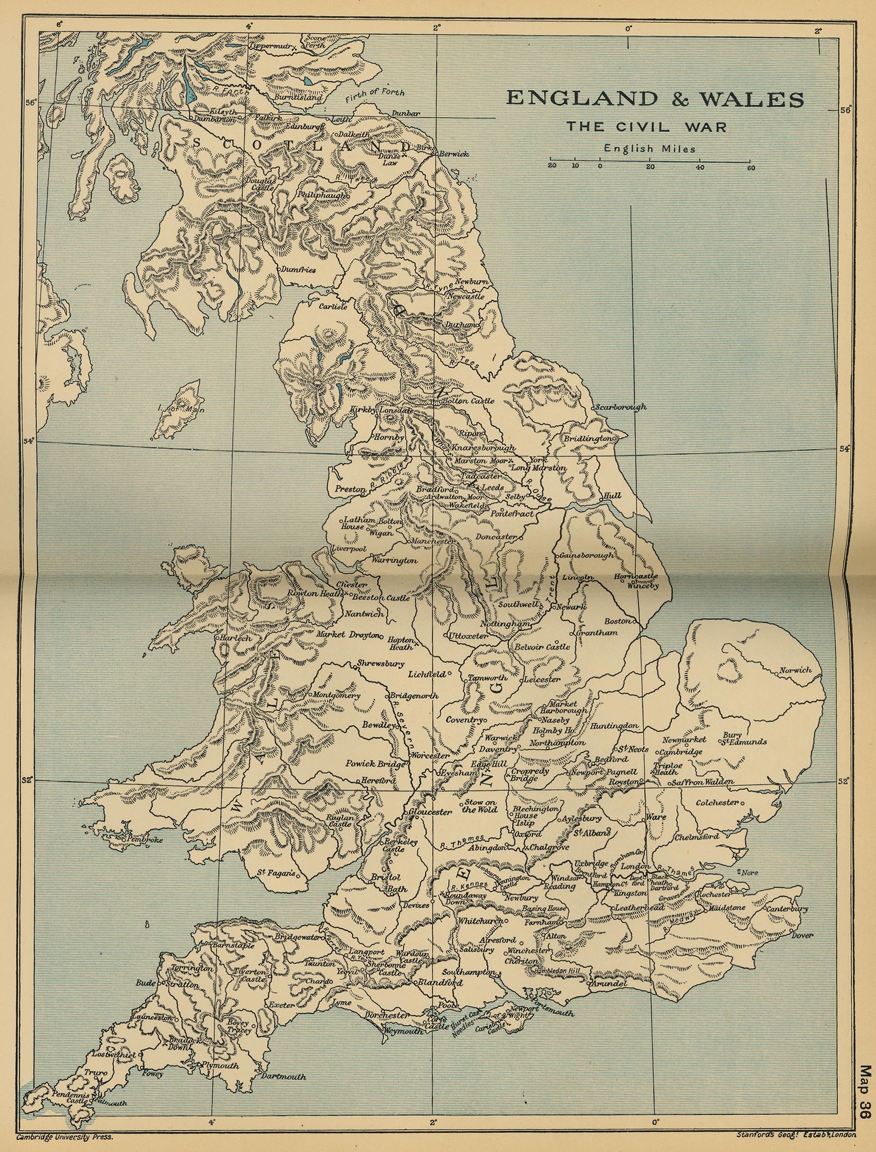
Looks like Mirage and I are back in business on this one. Hopefully he'll be able to find some time to modify the kingdoms Britannia map to mid-17th century spec. What we need are maps that show regions, cities and roads.
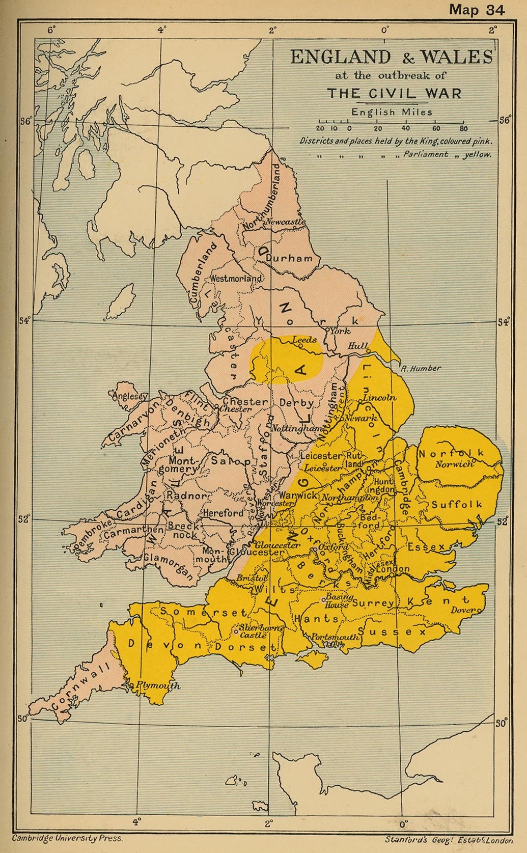
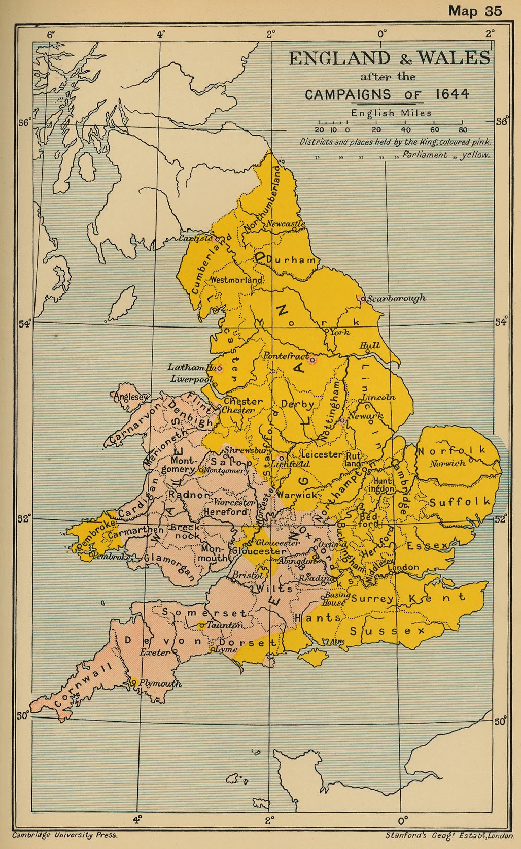
These maps are a good start:
Spoiler Alert, click show to read:
At the outbreak of the war:
After the campaigns of 1644
England map that shows towns
I counted something like 32 counties in England alone with around 15 or 16 in Wales. I counted roughly 17 regions in England in the Britannia campaign. To avoid the game becoming siege: total war I think the map will need to be scaled up 1.5 or 2 times and I'll most likely try to condense the number of counties to around 25 by joining small counties and counties that didn't see so much fighting.
Britannia campaign map
but I don't think I can provide pictorial references (without using Osprey etc. right now)
These images are from Amazon so I think they are ok to post:
Here is a list of counties (regions) and how I have sometimes combined 2 to prevent an over-load of regions. Shows the name for the settlement also
Red = Controlled by Parliamentarians
Blue = Controlled by Royalists
England:
County ...... Settlement name
----------------
Cornwall .... Truro
Devon .... Plymouth
Somerset .... Taunton
Dorset .... Sherborne castle
Wiltshire = Combine berks and wilts .... Reading
Glouster .... Glouster
Hampshire (hants) .... Winchester
Surrey .... Guildford
Sussex .... Arundel
Kent .... Dover
Essex = (Combine Middlesex, Essex and hertford) .... London
Oxford = (Combine Buckingham and Oxford) .... Oxford
Cambridge = (Combine Huntindon and Bedford and Cambridge) .... Cambridge
Leicester = (Combine Leicester and Rutland) .... Leicester
Northampton .... Northampton
Worcester = (Worcester and Warwick) .... Worcester
Stafford .... Lichfield
Herefordshire .... Hereford
Salop .... Shrewsbury
Suffolk .... Bury Saint Edmunds
Norfolk .... Norwich
Lincoln .... Lincoln
Nottingham .... Nottingham
Derby .... Derby
Lancaster .... Lathom House?
Chester .... Chester
Cumberland = (Combine Westmorland and Cumberland) .... Carlisle
Northumberland = (Combine Northumberland and Durham) .... Newcastle
York .... York
Total number of English regions = 29
Wales
County ...... Settlement name
----------------
Pembroke .... Pembroke
Glamorgan ....
Brecknock = (Brecknock and Monouth) ....
Cardigan = (Carmarthen and Cardigan) ....
Radnor = (Radnor and Montgomery) ....
Carnarvon = (Carnarvon and Merioneth) ....
Denbigh = (Denbigh and flint) ....
Total number of Welsh regions = 7
Royalist regions = 18
Parliamentarian regions = 18
Total number of regions = 36
Starting positions of commanders
------------
North:
Sir Thomas Fairfax (Leeds) (Army wears red coats with blue cuffs)
Earl of Newcastle (York, approaching Hull) (Army wears White coats with black trousers)
South West:
The Earl of Stamford (heading south away from Hereford) (Army wears dark blue/black coats, white cuffs, and red trousers )
Sir Ralph Hopton (Cornwall) (Army wears blue coats with mixed trousers)
Center:
The 3rd Earl of Essex (London) (Army wears Tawney orange coats)
Oliver Cromwell commanding of a large cavalry force (Cambridgeshire) (Ironsides)
Edward Montagu, 2nd Earl of Manchester (Essex) (Army wears green lined red coats and green trousers)
Charles I, The King (Oxford) (Army wears maroon coats with white cuffs)
Prince Rupert (Oxford) (Army wears maroon coats with white cuffs)
Partrick Ruthven Earl of Forth (Oxford) (No regiment)
South:
Sir William Waller (Hampshire) (Cavalry commander with a force of militia?)
Sir George Goring (portsmouth) (Coat colour unknown, likely force was militia)
Midlands:
Robert Greville, 2nd Baron Brooke (Warickshire) (army wears purple coats).
Spencer Compton, 2nd Earl of Northampton (Worcester) (Army wears green coats with red trousers)
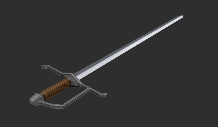
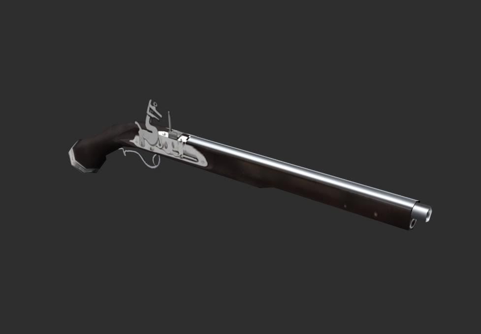
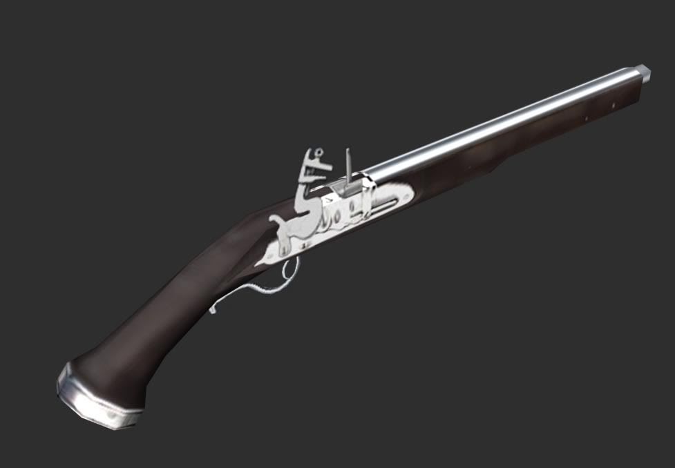
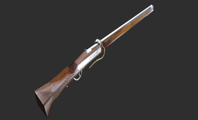
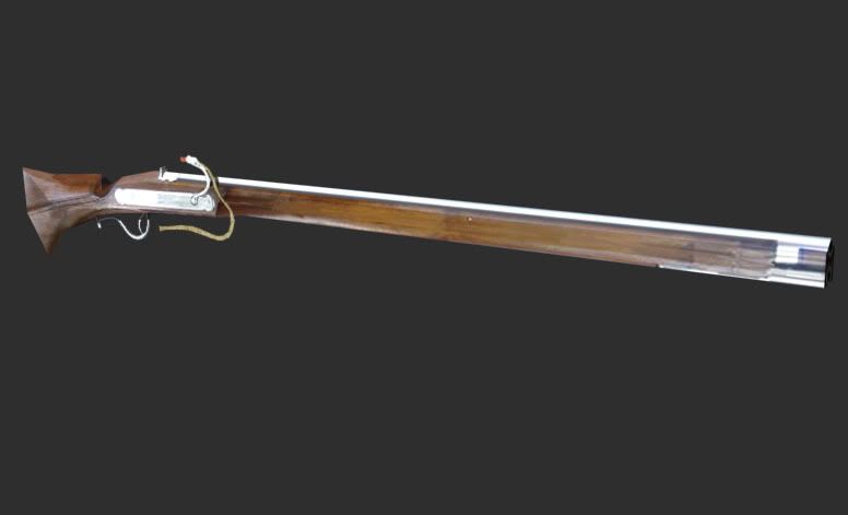
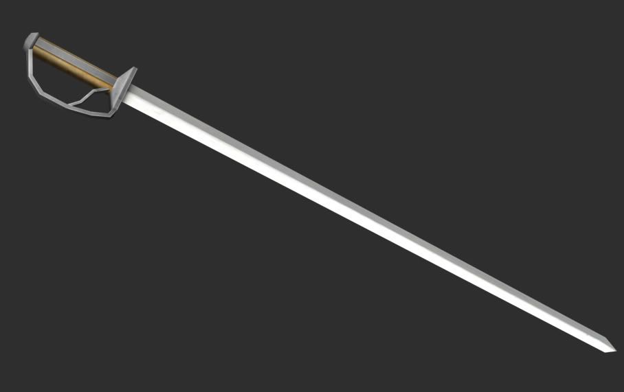
A new infantry sword. Ironically this blade will rarely be seen as musketeers won't fight with swords, they will melee with their sharpened musket butts.
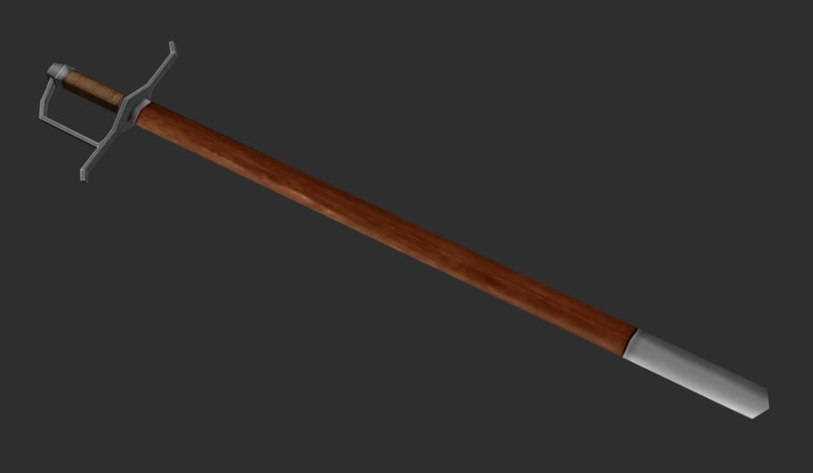
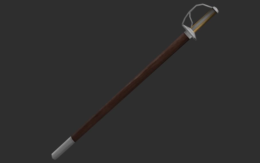
And in the sheath.
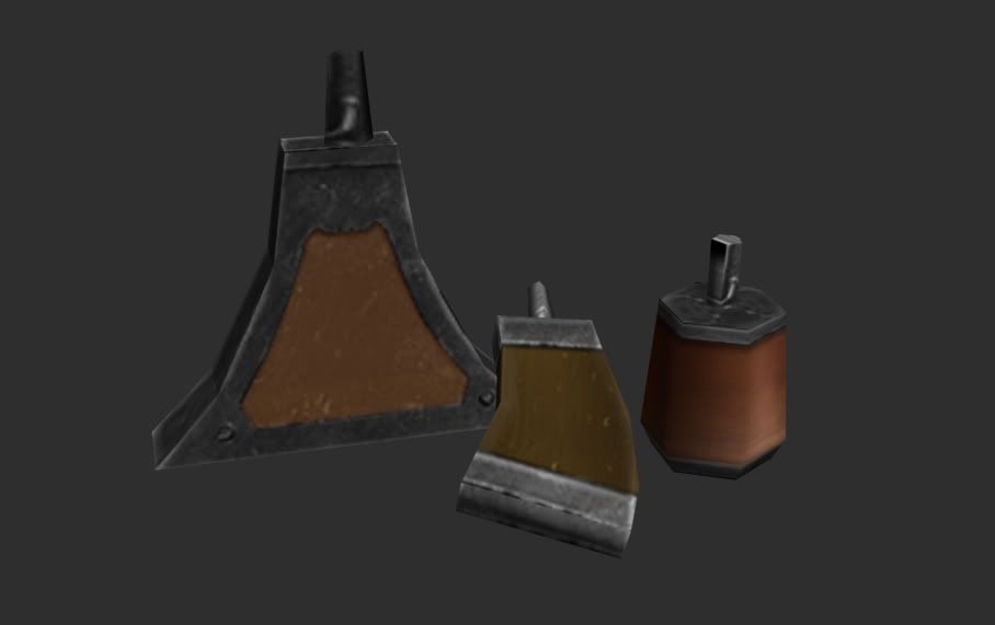
Powder flasks.
Cheers
Last edited by AlphaDelta; August 09, 2008 at 05:43 AM.
Reason: dp
Beautiful work AD, you'll get some sigs sent your way for shuare
Besides I think I got a book titled Warfare in Britain, or something like that. Got a lot of stuff on the English Civil War so I'll probably be able to dig up some info there if you want.
Granted Lettre de Marque by King Henry V - Spurs given by imb39
Сканија је Данска
عیسی پسر مریم گفت :' جهان است پل ، عبور بیش از آن است ، اما هیچ ساخت خانه بر آن او امیدوار است که برای یک روز ، ممکن است برای ابدیت امیدواریم ، اما ماندگار جهان اما ساعت آن را صرف در دعا و نماز برای استراحت است نهان All of the Balkans is not worth the bones of a single Pomeranian grenadier.
Otto von Bismarck
This looks like a really nice project, best of luck on it, not that you need it . As a non-brit the period of the mod is not one I'm very familiar with, so it should be interesting to play. I like the decision to keep it simple also, I remember playing Arthurian: Total War and loving the scope of the map, but being alienated from it due to the fact the unit names were so linguistically obscure just for the sake of etymological realism. If I can't even pronounce the units I'm using it tends to be hard to enjoy using them .
Anyways, will be watching the development of this with high hopes.
Aterdag, whatever you can post will be useful. I'm still in the research phase. I'm looking for information about individual generals and field marshals, where they were at the start of the war in 1642 and the composition and dress of their armies.
If I can't even pronounce the units I'm using it tends to be hard to enjoy using them .
This shouldn't be a problem in this mod. Units will be named Royalist x or Parliamentarian y i.e Royalist musketeers or Parliamentarian pikemen.
Red = Controlled by Parliamentarians
Blue = Controlled by Royalists
England:
County ...... Settlement name
----------------
Cornwall .... Truro
Devon .... Plymouth
Somerset .... Taunton
Dorset .... Sherborne castle
Wiltshire = Combine berks and wilts .... Reading
Glouster .... Glouster
Hampshire (hants) .... Winchester
Surrey .... Guildford
Sussex .... Arundel
Kent .... Dover
Essex = (Combine Middlesex, Essex and hertford) .... London
Oxford = (Combine Buckingham and Oxford) .... Oxford
Cambridge = (Combine Huntindon and Bedford and Cambridge) .... Cambridge
Leicester = (Combine Leicester and Rutland) .... Leicester
Northampton .... Northampton
Worcester = (Worcester and Warwick) .... Worcester
Stafford .... Lichfield
Herefordshire .... Hereford
Salop .... Shrewsbury
Suffolk .... Bury Saint Edmunds
Norfolk .... Norwich
Lincoln .... Lincoln
Nottingham .... Nottingham
Derby .... Derby
Lancaster .... Lathom House?
Chester .... Chester
Cumberland = (Combine Westmorland and Cumberland) .... Carlisle
Northumberland = (Combine Northumberland and Durham) .... Newcastle
York .... York
Total number of English regions = 29
Wales
County ...... Settlement name
----------------
Pembroke .... Pembroke
Glamorgan ....
Brecknock = (Brecknock and Monouth) ....
Cardigan = (Carmarthen and Cardigan) ....
Radnor = (Radnor and Montgomery) ....
Carnarvon = (Carnarvon and Merioneth) ....
Denbigh = (Denbigh and flint) ....
Total number of Welsh regions = 7
Royalist regions = 18
Parliamentarian regions = 18
Total number of regions = 36
Starting positions of commanders
------------
North:
Sir Thomas Fairfax (Leeds) (Army wears red coats)
Earl of Newcastle (York, approaching Hull) (Army wears White coats)
South West:
Colonel Ruthin(Devon)
Sir Ralph Hopton (Cornwall) (Army wears blue coats)
Center:
The 3rd Earl of Essex (London) (Army wears Tawney orange coats)
Charles I, The King (Oxford) (Army wears blue coats)
South:
Lord Stamford (Somerset) (Army wears red coats)
Sir George Goring (portsmouth) (Coat colour unknown, likely force was militia (blue))
Midlands:
Edward Montagu, 2nd Earl of Manchester (Warwickshire) (Army wears green lined red coats)
Spencer Compton, 2nd Earl of Northampton (Worcester) (Army wears green coats)
I would recommend Preston as the capital of Lancashire.
Other than that, good luck with this mod! I remember learning about the civil war in school just after I'd got Rome TW (then newly released) and remarking to a friend that there should be a Total War for it...
I look forward to playing!


 Especially considering the quality of work you are capable of, mapper and whatever else you would need should be no problem to find for you.


 Thanks again for the information, it's invaluable to project and educational to me atleast.


")
")


")
")
")


 . As a non-brit the period of the mod is not one I'm very familiar with, so it should be interesting to play. I like the decision to keep it simple also, I remember playing Arthurian: Total War and loving the scope of the map, but being alienated from it due to the fact the unit names were so linguistically obscure just for the sake of etymological realism. If I can't even pronounce the units I'm using it tends to be hard to enjoy using them
  .
.