
Originally Posted by
wilddog

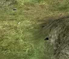
Are you sure? I was working on a new map today and although I only have a base set of heights (as I'm working on rivers) I could only spot 2 black rectangles. One of them was in the middle of a set of 1,1,1 pixels? Also it didn't seem to appear on similar such pixels. I haven't looked at this in detail yet but I'm not so convinced its the same as the triangle problem. If it was I would of expected lots more and on specific positions.
King Kong - the heights/ground types/Climates are on a grid of size 2*+1 versus regions. Only pixels showing as odd, odd coordinates (at least in paintshop) end up being used to determine the terrain type on the campaign map. Therefore even if you copied a set of pixels from vanilla you may be out of line by one pixel on your new map thats what Alpaca meant.


 Reply With Quote


")


